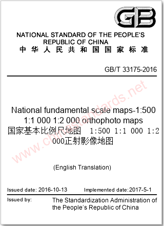
GB/T 33175-2016 in English
VALIDNational fundamental scale maps-1:500 1:1 000 1:2 000 orthophoto maps
- Issued on:2016-10-13
- Implemented on:2017-05-01
- File Format:PDF
- Delivery:Via email within 1~3 business days
$243.00
| Standard No: | GB/T 33175-2016 |
| Document status: | VALID |
| Title in English: | National fundamental scale maps-1:500 1:1 000 1:2 000 orthophoto maps |
| Title in Chinese: | 国家基本比例尺地图 1:500 1:1 000 1:2 000正射影像地图 |
| Language: | English |
| File Format: | Electronic (PDF) |
| Delivery: | Via email within 1~3 business days |
| Issued on: | 2016-10-13 |
| Implemented on: | 2017-05-01 |
| ICS Classification: | 07.040-Astronomy. Geodesy. Geography |
| Chinese Classification: | A79-Map printing |
| Professional Classification: | GB-National Standard |
| Related Keywords: | national basic scale orthophoto maps
national basic scale maps orthophoto maps orthophoto maps introduction interpretation fundamental scale |
| Related Topics: | National Architecture Map
map local 1 normally open Imaging National Fund germany map map country tree GBT33175 GB/T 33175-2016 cartographic scale international National basic topographic map survey gbt33175 |
《GB/T 33175-2016国家基本比例尺地图 1:500 1:1 000 1:2 000正射影像地图》由TC230(全国地理信息标准化技术委员会)归口,主管部门为自然资源部(测绘地理)。
Introduction
Interpretation of the Technical Standards for National Basic Scale Maps 1:500, 1:1000, 1:2000 Orthophoto Maps
1. Overview of the Standard
This standard specifies the composition, technical requirements, content and expression, quality inspection and marking of national basic scale maps 1:500, 1:1000, 1:2000 orthophoto maps, and is applicable to the production, quality control and use of national basic scale orthophoto maps.
2. Comparison of technical frameworks
| Technical dimensions | 1:500 | 1:1000 | 1:2000 |
|---|---|---|---|
| Resolution (m) | 0.05 | 0.1 | 0.2 |
| Plane position mean error (mm, on the figure) | 0.6 (flat land), 0.8 (mountainous land) | 0.6 (flat land), 0.8 (mountainous land) | 0.6 (flat land), 0.8 (mountainous land) |
| Edge error (pixels) | ≤2 pixels | ≤2 pixels | ≤3 pixels |
3. Background of standard formulation
With the development of surveying and mapping technology, the importance of orthophoto maps in the fields of land and resources management, urban planning, etc. has become increasingly prominent. This standard is based on modern photogrammetry and remote sensing technology to ensure the high accuracy and operability of data.
4. Analysis of technological evolution
Case study: vector feature processing method
In orthophoto maps, the superposition of vector features such as kilometer grids and inner map contours must follow the principle of semi-transparency to ensure that the clarity of the image base map is not affected. For example, traffic roads use 0.1mm continuous solid lines, combined with transparency processing, to maintain the readability of image textures.
5. Implementation Suggestions
- Production stage: Ensure that the 2000 National Geodetic Coordinate System and Gauss-Krüger projection are used, and the resolution meets the standard requirements.
- Quality control: Strictly inspect in accordance with GB/T18316, including inspection of plane position accuracy, fit accuracy and edge accuracy.
- Data storage and distribution: Follow the data organization and file naming rules specified in CH/T9012, use CDs as the main storage medium, and attach complete metadata information.

Loading PDF document...
Error loading PDF. Please make sure the file is valid and try again.
We also recommend
-

GB/T 12343.1-2008 in English
Compilation specifications for national fundamental scale maps - Part 1:compilation specifications for 1:25 000 1:50 000 1:100 000 topographic maps
2008-06-20 -

GB/T 33176-2016 in English
National fundamental scale maps--1∶5001∶1 000 1∶2 000 topographic maps
2016-10-13 -

GB/T 15968-2008 in English
Specifications for remote sensing image plan making
2008-06-20 -

GB/T 35630-2017 in English
Data specification for mobile phone map
2017-12-29 -

GB/T 13989-2012 in English
Subdivision and numbering for the national primary scale topographic maps
2012-06-29 -

GB/T 24355-2023 in English
Geographic information—Portrayal
2023-05-23 -

GB/T 17158-2008 in English
Specifications for digitizing 1:500,1:1 000 and 1:2 000 topographic maps
2008-06-20 -

GB/T 19996-2017 in English
Quality assessment of paper map publications
2017-12-29


